In fairness, it's 230 miles from Missoula to Livingston... and with all due respect to the beauty and grandeur of Montana... it's not an incredibly scenic stretch. Also, there is not really a good route between the two cities (the ACA map actually has me traveling on the interstate for a while. no thanks).
Anyway, Missoula makes a good stopping point because it's home to the Adventure Cycling Association - a bit of a mecca for touring cyclists (the nice folk who produce the maps I've been using).
The route would be relatively simple, but there is a decent 1,200 ft climb thrown in there (this seems like a fair time to remind you that the "big hill" on which I had trained at Castaway was 160 feet).
The climb wasn't that bad, and I had some fun descents. The wind was still in my face (seriously?!), but it wasn't very strong today... so the ride was mostly pleasant. The only drawback was the road I used was pretty busy and didn't always have a lot of extra room for cyclists. And the scenery had moved from "totally spectacular" to "very impressive". Pity.
 |
| separate bikeway for several miles out of Polson. wonderful. |
 |
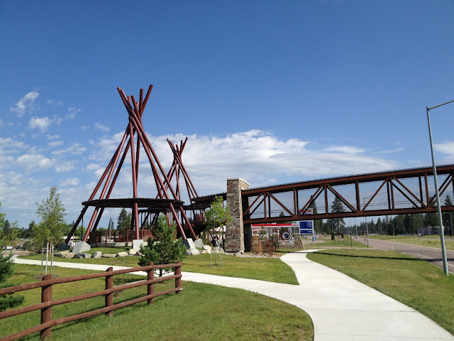
| the bikeway even had its own bridges to cross the busy highway (which I would later be biking down) those teepee structures are also ramps up to the overpass |
Most of the route today passes through the Flathead Native American Reservation - home to the confederated Salish and Kootenai tribes. (European explorers called them the "Flathead" people... Salish is the term they use for themselves. It means "the People").
I'm no linguist, but their language has to be one of the more complicated languages in our hemisphere. Seemingly, anyway.
 |
| mud creek |
 |
| mission creek |
Look at those last two signs again... your best guess: what's the word for "creek"?
 |
| check out the translation also... these animal trails over highways are awesome for wildlife and motorists alike. |
From the above photos, you can get an idea of what the ride was like. Highway 89 has room in most places, but the rumble strips make it tighter in some spots... and that truck coming under the animals' trail in the photo above gives you an idea of the traffic.
Rolling hills, decent traffic, nice views, overall a nice day, but I was glad to arrive safely.
 |
| made it. |
 |
| hey! bike lane! alright! |
 |
| tour cycling mecca... |
 |
| door handle(bars)... I like it. |
 |
| if you bike there, you are added to the "hall of fame" ... even if you look homeless |
 |
| can you find me? |
After our visit to the ACA, we loaded stuff in the car and headed to Bozeman - where we'd stay for the night... in the WORST motel room I've ever been to or even heard of. The worst.
Dad said he had stayed there before (!) and that it was simple/no frills... but clean and straight forward. It was not.
The motel was called the "Blue Sky Motel"... and I'm using the verb *was* because according to my recent google search has either closed or relocated. Here are a couple of the actual reviews:
"cheapest place to stay. you get what u pay for."
"scary place and really gross! good place for alcoholics and drug dealers with flea ridden dogs."
It seems worth mentioning that the Blue Sky Motel did allow pets.
I slept on a sleeping pad on the floor, in my sleeping bag... doing my best not to touch ANYTHING. I will not post pictures (of the bed, bathroom, or coffeemaker). You are welcome.
To end on a positive note: dinner at Montana Ale Works just down the street was excellent.
Also, by tomorrow night, I'll be in Yellowstone National Park

No comments:
Post a Comment